The History Walk Book Collection
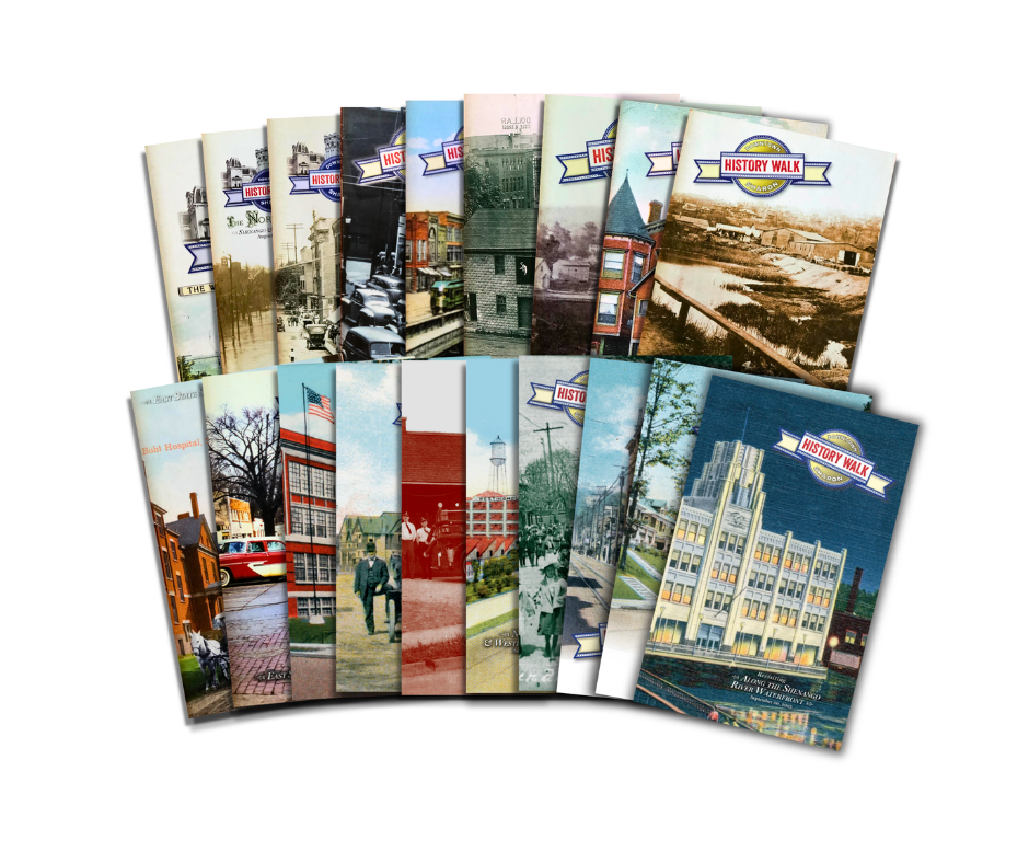
The History Walk Book Collection
Buy the entire Sharon History Walk book collection and save! This special offer includes all 19 History Walk books. We’ve become famous for our Downtown Sharon History Walks, with their collectible booklets of history and photos, which cover all areas of the city, from our historic downtown business district to our distinctive neighborhoods, and span hundreds of years. It’s the perfect gift that includes our entire collection!
The West Hill: Irvine Avenue and West State Street (28 pages, 5.5 x 8.5")
The North Flats: Shenango and Penn Avenues (40 pages, 5.5 x 8.5")
Vine Avenue and Railroad Street (40 pages, 5.5 x 8.5")
The Lower East Hill (32 pages, 5.5 x 8.5")
Along the Shenango River/South Ward (36 pages, 5.5 x 8.5")
Sharpsville Avenue (36 pages, 5.5 x 8.5")
Main, North Irvine and Ellsworth (32 pages, 5.5 x 8.5")
Railroad Avenue, North Dock Street, Dayton Way (32 pages, 5.5 x 8.5")
South Dock and Budd Streets (40 pages, 5.5 x 8.5")
East State Street/Middle East Hill (44 pages, 5.5 x 8.5")
East State Street from Jefferson to Case and Euclid Avenue (40 pages, 5.5 x 8.5")
Uptown Area: Case Avenue & Eastward to the city line (40 pages, 5.5 x 8.5")
Prospect Heights (36 pages, 5.5 x 8.5")
North Sharon: Thornton Hall area (32 pages, 5.5 x 8.5")
North Sharon: Westinghouse & Thornton Street south to Meek Street (44 pages, 5.5 x 8.5")
Revisiting the North Flats: Shenango and Penn Avenues (44 pages, 5.5 x 8.5")
Revisiting West State Street (44 pages, 5.5 x 8.5")
South Irvine Avenue (32 pages, 5.5 x 8.5")
Revisiting Along the Shenango River Waterfront (40 pages, 5.5 x 8.5")
The West Hill: Irvine Avenue and West State Street (28 pages, 5.5 x 8.5")
HIGHLIGHTS
First Church of Christ Scientist
Church of the Sacred Heart and its school buildings
The Wayne Building
First Baptist Church
The former Baptist/Methodist cemetery whose graves were moved to Oakwood Cemetery
Carley mansion
Williams mansion
McIntyre mansion
J. V. Rose mansion
DeForeest mansion
Bicycling the West Hill in 1894 Claims Victim
Perkins mansion and estate
Stevenson mansion
Other notable West Hill mansions
Color 1920 Sanborn Map Co map showing every structure in the tour area
==================================
The North Flats: Shenango and Penn Avenues (40 pages, 5.5 x 8.5")
HIGHLIGHTS
State and Shenango block (G.C. Murphy's/Outdoor Army-Navy)
Thomas Theater
Liberty Theatre
Shenango Valley Water Co.
Sharon post offices
Modern floods, including the 1959 ice flood
Evangelist Billy Sunday comes to town
Sharon schools/Penn State Shenango campus
Sharon Congregational Church
House of Torah synagogue/Christ the King Catholic Church
Yazvac Place/Sharon patrolman Joesph Yazvac, killed in the line of duty
Harold Brest, bank robber, kidnapper and unsuccessful Alcatraz escapee
Ashton home
McDowell Manor apartments
The V Bridges
The Great Flood of 1913
Color 1920 Sanborn Map Co map showing every structure in the tour area
==================================
Vine Avenue and Railroad Street (40 pages, 5.5 x 8.5")
HIGHLIGHTS
State and Vine Koehler jewelry store/Penn-Ohio Cigar Co.
Odd Fellows hall/old McDowell National Bank
The Sharon Club
Masonic Temple/The Corinthian
The Ashlar Club
The architects who left their mark on Sharon
The parking garage
Hoffman Motor Co.
Utility and transportation convergence at Penn Power substation (former gas works, streetcar power house, Erie Extension Canal)
A. Wishart lumber and contracting
F.E. Kerr Co./Virostick Moving and Storage
Messina Brothers produce company/"The Pitts" apartments
Sharon Hotel
The Ohio Hotel
Boyles brothers building/Palm Restaurant/Old Tymer Hotel
The Shenango House hotel/Mark Twain visits Sharon
Thompson Block
Whitmer Smith store/Jubelirer family
Color 1920 Sanborn Map Co map showing every structure in the tour area
==================================
The Lower East Hill (32 pages, 5.5 x 8.5")
HIGHLIGHTS
The Clark/Jones/Lee Block
Carver Block/Loose Caboose Shoppes
1910 train-streetcar wreck
Smith Drug Store
Hamory Bank/Dollar Title building
Strawbridge mansion/Petrini Insurance building, Lulu's Cafe
Haywood mansion
Grace Place carriage house
Wallis houses
Bundel/Forker/Whalen mansion
Dr. Thomas Elliott mansion and hospital
Koehler/Marchetto mansion
F.H. Buhl Club
Alexander McDowell mansion/McConnell and Stevenson funeral homes
Covenant Presbyterian Church
Library site at East State Street and Sharpsville Avenue
Urban renewal and the Sharon downtown mall/office complex that was never built
Color 1920 Sanborn Map Co map showing every structure in the tour area
==================================
Along the Shenango River/South Ward (36 pages, 5.5 x 8.5")
HIGHLIGHTS
Protected Home Circle/Protected Life buildings
State Street bridges
Floods
First National Bank
Old city hall/fire department
George S. Warren II Park/giant can opener sculpture
Chestnut Street bridge
Quaker Steak and Lube
Old Sharon High School
River Gardens Park
Daffin's Candies
Hannah Building and old peddler's wagons stored there
Color 1920 Sanborn Map Co map showing every structure in the tour area
==================================
Sharpsville Avenue (36 pages, 5.5 x 8.5")
HIGHLIGHTS
St. Paul's German Church
Odd Fellows Lodge/Landino residence
The Sunshine Home
Former bus depot
A&P grocery stores
Wallis and Carley lumber yard
Erie Extension Canal basin and Pine Hollow
Buhl Armory/Julia F. Buhl Girls Club
Site of Strawbridge mansio/streetcar diner/Lulu's Cafe
The Applegate Building and the apartment buiding it was supposed to be
Streetcar right-of-way along Silver Street
The Treasure Chest/street widening
Former St. Paul's Evangelical and Reformed Church
Whitehead-Eagle Corp.
F.E. Kerr movers
Our Gang's block
DeBlase block
Laskey's Furniture block
Color 1920 Sanborn Map Co map showing every structure in the tour area
==================================
Main, North Irvine and Ellsworth (32 pages, 5.5 x 8.5")
HIGHLIGHTS
South Main Avenue businesses and residences
Moose Club/U.S. Sen. James J. Davis
Author and world traveler Sarah Graham Morrison
N.Y. Central Railroad depot
Erie Railroad depot
Businesses on North Main Street
Ivor J. Lee plumbing and its manufacturing plant
First Presbyterian Church
First United Methodist Church and its three previous churches destroyed by fire
Stevenson mansion
West Hill Elementary School site and former ballfield
The tragic death of 4-year-old Leah Dilley
Biggin's Dairy plant
Original Ruth AME Zion Church
Railroad bridges
Geological survey markers
Color 1920 Sanborn Map Co map showing every structure in the tour area
==================================
Railroad Avenue, North Dock Street, Dayton Way (32 pages, 5.5 x 8.5")
HIGHLIGHTS
Thompson Block/M&M Bank
Shenango House/Boyle Building and Mark Twain's visit
Railroad watchman's hut
Ferd Dalo
Gable hotel/tavern/theater
Sharon Coal and Ice
Boyles Brothers Restaurant/Old Tymer Hotel
Ohio Hotel/forgotten Grand Theater
The Wharton/Sharon Hotel
Railroad milepost 70
Messina Brothers produce company/"The Pitts" apartments
Parking garage/Malsom monument works
A. Wishart & Sons lumber and contracting
Penn Power substation that was once a manmade-gas plant and a streetcar power house
Erie Extension Canal lock
Rosenblum/Golde Dawn warehouse
Sharon Livery
City Roller Mills/F.E. Kerr and Virostick moving and storage companies
Color 1920 Sanborn Map Co map showing every structure in the tour area
==================================
South Dock and Budd Streets (40 pages, 5.5 x 8.5")
HIGHLIGHTS
Connelly Blvd. at South Dock St. (roundabout site)
191 East Connelly Blvd. (formerly 112 S. Dock St.) Baines realty and insurance/Richard G. English and Associates
Erie RR/P&LE RR joint freight house
The Erie Extension Canal basin
Dock Street bridge over Pine Run
The east side of South Dock, south of the roundabout (including Flower Lumber, Johnson-Sizer Co.)
Apollo Maennerchor Club
Hotel Ly-Jore
The June 7, 1947, tornado
Former Coca-Cola bottling plant
Trains, trains and automobiles
Gordon Ward
The old city dump
City garage/former city incinerator site
East Budd at the freeway/last house standing
The Bentley mill, Sharon’s first industry
Calvert Lumber
Union Brewing Co. brewery
Color 1920 Sanborn Map Co. map showing every structure in the tour area
==================================
East State Street/Middle East Hill (44 pages, 5.5 x 8.5")
HIGHLIGHTS
George Devitt house
Dr. W.B. Isenberg house
Sharon Alliance Church
Gas station/Wm. Leslie house
Daffin’s Candies (old Loblaw’s)
Fruit mansion
Buhl mansion
Ackley house
Forker Apartments
Billy Whitla
VFW (former Carver house)
Streetcar right-of-way
John Leslie mansion
Michaelene’s Day Spa
Gas station/moved Gilbert house
War monument, horse trough
J.M. Willson mansion/Sample-O’Donnell Funeral Home
McClure mansion
Hart house/former Harshaw realty
Haney house/greenhouse
Heilman, Jones, Hannah, Fenstenmacher mansions
Wright house/McGrath, McGonigle funeral homes
Mazzola Building/Isaly’s
Gas station/moved Wiesen house
Christian H. Buhl Hospital/Sharon Regional Medical Center
Brady Court
School of Nursing
State Towers apartments
1st Presbyterian Church
Color 1920 Sanborn Map Co. map showing every structure in the tour area
==================================
East State Street from Jefferson to Case and Euclid Avenue/Upper East Hill (40 pages, 5.5 x 8.5")
HIGHLIGHTS
19 Jefferson – House moved and refaced in brick as offices
Old and current St. Joseph church, school. The story that St. Joe's
was intended to be a cathedral for a new diocese
Goldberg Plaza at State and Jefferson
Farnicorn jewelry store
Bello’s Pizza/Ferd’s Nut Shop
South side of State St. from Woodrow to Stambaugh
McBride Funeral Home
811 Building
Watson’s garage
Never-built sites of Shenango Inn and State Theatre at State and Euclid
Former East Hill fire station
Hilltop Anchor Drug Store
Dr. Chas. Brennan mansion/office
McGonigle Ambulance maintenance garage/former gas station
Kloos service station
Deneen Dairy store and restaurant
House moved around corner onto Flowers Avenue
Bachman mansion
Kranz mansion
Brainard’s service station/Sharon Chrysler-Plymouth
Boyd mansion
Wiltsie mansion
Judge J.A. McLaughry house
Hugh Garvey/George Warren Jr. house
Drs. Lartz and Woods/attorney Bill Madden office
Huether twin houses
Fahnline mansion
Jefferson Avenue Elementary School
Newell’s Market
Color 1920 Sanborn Map Co. map showing every structure in the tour area
==================================
Uptown Area: Case Avenue & Eastward to the city line (40 pages, 5.5 x 8.5")
HIGHLIGHTS
The 1924 high school/junior high/Case Avenue building
The new Case Elementary School
The new high school
What once stood on the high school site
Heinz/Marquard mansion/McGonigle Funeral Home
Wein Motors bldg.
Old Lawson’s
Nye's Market/Shenango Valley Meats
Coal mining and the resulting subsidence
Housing developments residential growth of the 20th century
Hickory Township School No. 8/Strawbridge School
State Street Professional Building
Pollock-Timblin automotive dealership (Diehl Hyundai)
Allum-Williams automotive dealership (Diehl Ford)
Tip Top Diner
Heiges Bros. Electric/Dr. Jerry's Cycle
Sharon American Legion Post 299
Streetcar line right-of-way to Buhl Farm Park
Uptown Korner Market
Bottenfield Garage
Al Shaver Little League Field
The Shenango Inn
Tiger Stadium
Color 1926/1957 update Sanborn Map Co. map showing every structure in the tour area
==================================
Prospect Heights (36 pages, 5.5 x 8.5")
HIGHLIGHTS
Prospect Heights and C.M. Musser elementary schools
Houses on the go that were picked up and moved
Corner grocery stores
The streetcar line extension into Prospect Heights
The 1947 tornado
St. Stanislaus Kostka Roman Catholic
Former Coulter Funeral Home, 247 S. Oakland Ave.
The three viaducts that have spanned Pine Hollow on Oakland Ave.
The William Stambaugh house, 174 S. Oakland Ave.
The Joseph Traxler house, 447 Prindle St.
Walnut Street and the wall at the foot of Prindle St.
The Fred Hoelzle house, 249 Walnut St.
The (demolished) John Hubert house, 284 Prindle St.
The Parker McDowell and A.W. "Dude" McDowell house, 300 Prindle St.
The Chauncey Prindle homestead, 346 Prindle St.
The Walter Whitehead house, 384 Prindle St.
The Joseph Barry house, 406 Prindle
Maple Villa, the Wales/Fogle/Abbatiello house, 603 Prindle St.
East Side Church (Baptist-Disciples of Christ)
The Prospect Heights Club and social life in the heights
Color 1920 Sanborn Map Co. map showing every structure in the tour area
Black-and-white excerpt from the 1901 panoramic map of Sharon
==================================
North Sharon: Thornton Hall area (32 pages, 5.5 x 8.5")
HIGHLIGHTS
Former Thornton/McClintock elementary school served both Hickory and Sharon school districts, and Sharon's 1928 annexation of North Sharon Hickory Township land
The free Buhl Farm golf course (Dum Dum)
The former circus grounds at Bon Air Avenue and Thornton Street
Ristvey radio and electronics shop
North Sharon Volunteer Fire Co., the civic organization that never really fought a fire
Paul Krivosh Little League field
John Piccirilli Parking Area
Robert Price Recreation Area
Nurseryman Charles Heinz, the father of North Sharon and cousin of H.J. Heinz.
Early North Sharon landowners
Neighborhood architecture:
1247 Hall Ave.
1207 Hall Ave.
1327 Hall Ave.
1364 Hall Ave.
1365 Hall Ave.
1377 Hall Ave.
1395 Hall Ave.
Thornton Hollow, the streetcar viaduct buried beneath the roadway and how 350 feet of Hermitage keeps the city of Sharon and the borough of Sharpsville from ever touching
Dewey Park and the Deweyville neighborhood
Thornton Hall Bowling Lanes
Color 1957 Sanborn Map Co. fire-insurance map showing every structure in the tour area
==================================
North Sharon: Westinghouse & Thornton Street south to Meek Street (44 pages, 5.5 x 8.5")
HIGHLIGHTS
Sharon annexes North Sharon from Hickory Township
Residential growth in Sharon's new territory
W.D. Gamble Elementary School/Salvation Army
The Catwalk path to school along the cemetery
Oakwood Cemetery
Sharpsville Avenue businesses, past and present: Billy’s Black & Gold, Bill’s Avenue Lottery, Petrosky’s Market/Randy Bar
Acres of blacktopped parking for Westinghouse Workers
The Carpo-Russ Club
Industry of the past
Sharpsville Avenue houses moved, yards cropped to widen the street
Stories on photos on Westinghouse: The before, the heyday, the future:
Driggs-Seabury Ordnance Co./Savage Arms
Working down at The Westinghouse
A million-square-foot redevelopment encompasses everything from steel galvanizing to an aquaponic farm raising lettuce and fish
Color 1957 Sanborn Map Co. fire-insurance map showing every structure in the tour area
==================================
Revisiting the North Flats: Shenango and Penn Avenues (44 pages, 5.5 x 8.5")
HIGHLIGHTS
The Great Flood of 1913 and modern floods, including the 1959 Ice Flood
The current and 1910 post office building
Shenango Valley Water Co.
Sharon Motor Co., later the Salvation Army and Shenango Valley Civic Center
Herald Square and the Elks lodge site at Pitt Street and Shenango Avenue, including a never-built 9-story hotel that was intended to be the Shenango Inn community-funded hotel
First Federal/Huntington Bank tower
The V Bridges
The Welsh church on Penn Avenue
Sharon Congregational Church
The twin railroad bridges and the Mill Street bridge
Sharon Tube Co.
North Works of Carnegie Steel
Joseph Yazvac, the only Sharon policeman killed in the line of duty
House of Israel synagogue/Christ the King Catholic church
A villain in the ‘hood: Career criminal Harold Brest, who tried to escape from Alcatraz
Sharon schools/Penn State Shenango Campus
The Primary Health Network tower
Evangelist Billy Sunday brings his crusade to town in 1908
Color 1920 Sanborn Map Co map showing every structure in the tour area
==================================
Revisiting West State Street (44 pages, 5.5 x 8.5")
HIGHLIGHTS
Luna/Nuluna Theater block
The Sharon Store/Strouss Hirshbergs/The Winner
”AMJ” building/former Reyer’s shoe store/newsstand
Alpha Theater/Lurie building
Morgan Grand opera house
Porter Way
Columbia Theatre
Goldstein’s/Laskey’s furniture store
Salvation Army Citadel and Sharon Telegraph buildings
Mid-1800s William and Katie Budd home that later became a hotel/lunch room
Mid-100 block of West State, including Luse building
Applegate Block/Dinner Bell
Carver House hotel and opera house
Daus barbershop
Exchange Hotel/Johnston Furniture/Phoenix Restaurant
Demolished west side of West State Street during urban renewal
Color 1920 Sanborn Map Co map showing every structure in the tour area
==================================
South Irvine Avenue (32 pages, 5.5 x 8.5")
HIGHLIGHTS
The neighborhood's easy access and transportation to schools, work, shopping
Ghosts of A Street: 3 structures no longer there
296 A St., a bungalow designed by architect E.E. Clepper
The Hall Institute
323-25 A. St., which had its finale as a hounted house before being demolished
Walnut St. Lodge/Christian Science Church
Dr. John M. Irvine, namesake and community leader
The stylish homes of the 100 block fade away
St. Scholastica Academy/former Samuel Kimberly mansion
Former Nazarene Church
Intercity bus garage
McIntyre and Sons contractor office
Former gas stations at South Irvine and West Budd Street
Union Brewing Co.
Former fire station
Washington’s farewell address: The remaining stub that used to be part of Washington Street through the downtown
Where Sharon began with its first log cabin
Kissinger/Herrmann’s bottling company
Former Sacred Heart Church now the ACTS theater
Sacred Heart school
St. John’s Episcopal Church
Also:
1871 Sharon map
Excerpt of a 1901 panoramic map of Sharon
Color 1920 Sanborn Map Co map showing every structure in the tour area
==================================
Revisiting Along the Shenango River Waterfront (40 pages, 5.5 x 8.5")
HIGHLIGHTS
G. C. Murphy Co. Five and Dime/Outdoor Army-Navy/Allie's Sweet Tooth building
42-44 E. State St., the single-story building disguised as a 2-story
State Street bridges through the centuries
The First National Bank building
Floods in downtown Sharon
The Protected Home Circle/Gilbert's Risk Solutions building
Geo. S. Warren Jr. Park and the giant can opener artwork
The old Chestnut Street city hall/fire department
The original Quaker Steak & Lube restaurant
Moe’s Way Riverwalk
Old Chestnut Street bridge
The 1904 Sharon High School
River Gardens Park (formerly Bicentennial Park)
The original home of Daffin’s Candies
The Hannah building and the antique peddler's wagons that sat forgotten in an old barn behind it
1970s urban renewal and the giant shopping mall, office tower and rotating restaurant that was never built
A color 1920 Sanborn Map Co map showing every structure in the tour area
A mid-1950s aerial view of the downtown and South Ward when it was filled with houses and businesses before urban renewal removed them